Rainforest Sites of SignificanceClick here for the Victorian Rainforest Network websiteClick here for photos of rainforest scheduled to be loggedClick here for latest update on rainforest logging...East Gippsland has the most rainforest in Victoria...East Gippsland has by far the greatest number of Rainforest sites of significance in Victoria, as this graph illustrates. Over 65% of all Rainforest Sites of Significance (RSOS) areas are located in East Gippsland, making East Gippsland the richest rainforest region in Victoria. 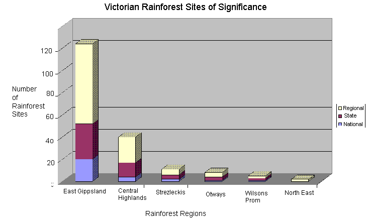
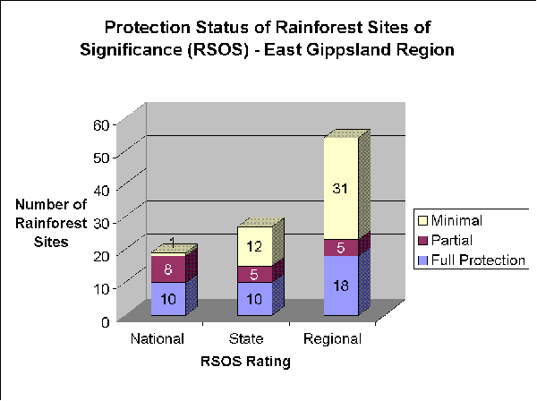
...Rainforest remains unprotected in East Gippsland...
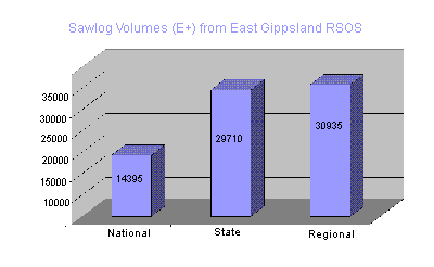
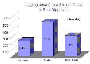
...Rainforest is being logged in East Gippsland...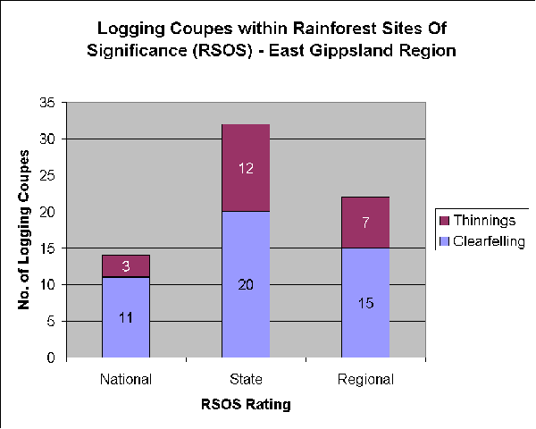 These graphs illustrate the extent of logging taking place in East
Gippsland's rainforest.
This indicates how much logging is scheduled in rainforest in East Gippsland over the next three years (proposed Wood Utilisation Plan 2003/4 - 2005/6). It does not include residual logs (residual logs are all woodchipped - a part of each other grade of log is woodchipped, but residual logs are taken just for woodchips). The actual amount of rainforest scheduled for logging is greater than these graphs indicate, due to incomplete data and the influence of woodchipping.
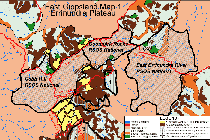
This map shows just a small part of East Gippsland on the Errinundra Plateau. It quite clearly shows how much logging has already taken place in National and State Rainforest Sites of Significance, as well as indicating (in green and yellow) areas scheduled for logging.
Data and Graphs courtesy of the Victorian Rainforest Network |